

Strahler Numbered Rivers
 kathorus
Traveler
kathorus
Traveler
While checking out some programming articles, I came across a link to an article on the Strahler Number - https://en.wikipedia.org/wiki/Strahler_number
I immediately made the connection to my map-making hobby. I learned awhile ago about mapping good rivers, start small, work your way up, etc... but this seemed to gel in a technical sense with me.
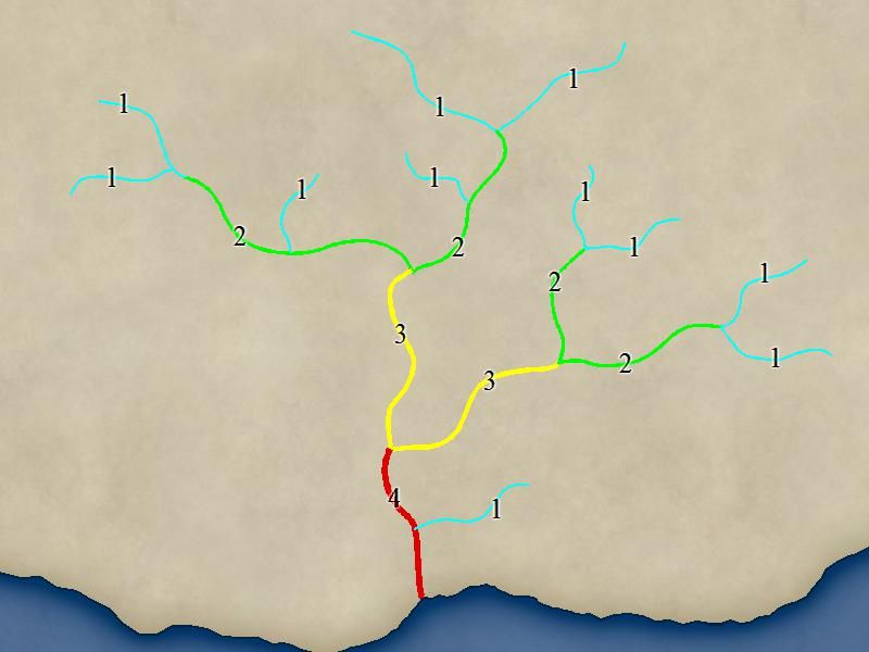
Basically, two streams of the same size (1) make a stream of a larger size (2), but two streams of different sizes make the size of the larger one.
So,
Same Size = 1+1 = 2, 2+2 = 3, 3+3 = 4, etc...
Diff Size = 1+2 = 2, 2+4 = 4, etc....
How you can use this info is to determine a good starting width for you source rivers, make a tool for it called "River 1" from the 'default' river style, specify the width and make it a distinct color, for each new size make a new tool and double the size, do this until you reach the mouth. This way you have a quick visual of the sizes of the rivers. When you're happy with the system, convert the colors into the appropriate "Water" style for your map.
Outline Form
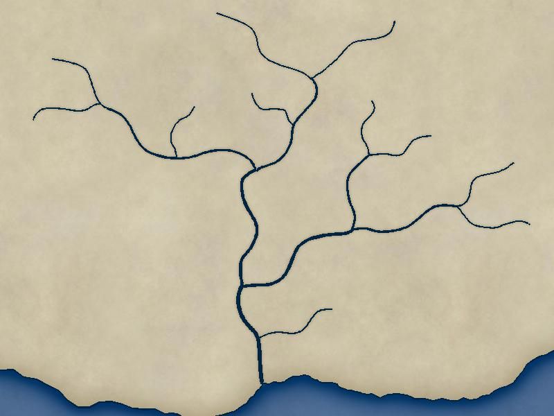
Map Form
I immediately made the connection to my map-making hobby. I learned awhile ago about mapping good rivers, start small, work your way up, etc... but this seemed to gel in a technical sense with me.
Basically, two streams of the same size (1) make a stream of a larger size (2), but two streams of different sizes make the size of the larger one.
So,
Same Size = 1+1 = 2, 2+2 = 3, 3+3 = 4, etc...
Diff Size = 1+2 = 2, 2+4 = 4, etc....
How you can use this info is to determine a good starting width for you source rivers, make a tool for it called "River 1" from the 'default' river style, specify the width and make it a distinct color, for each new size make a new tool and double the size, do this until you reach the mouth. This way you have a quick visual of the sizes of the rivers. When you're happy with the system, convert the colors into the appropriate "Water" style for your map.
Outline Form
Map Form
Comments