

Community Atlas - Continent D
 HadrianVI
Surveyor
HadrianVI
Surveyor
Hi Guys
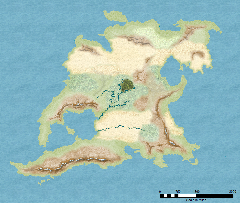
I already started mapping Continent D yesterday. Here's what I have so far.
There are some unfinished rivers and an isolated forest, which I put down to test how it is going to look.
So far I mostly focused on the terrain background and the mountains.
Since the Continent is huge, I didn't bother trying to use Mountain Symbols. Instead I used the same technique that I already used on the Berenur and Banjar Region Maps. I will further improve them until I'm satisfied. So far most of the mountains still need a lot of work.
The Terrain may seem a bit rough, but I this is just the background terrain. I will use another set of terrain on top of it. The purpose of this first set is to roughly define the climate zones and the height levels of the continent. Using a second set will hopefully allow me to draw green valleys between the mountain ridges:)

Comments
As for the rivers: This is the reason why I drew some "test rivers" to get a feeling it. I'm not quite happy with both of them, so they'll be reworked soon.
@Tonnichiwa: Thank you. I'm glad you like it.:)
Mountains ranges looking really good.
And a quick note of commiseration to Tonnichiwa on having to pull-out of this one. Reality sucks far too often...
Thank you for your comment, Shessar. I'm humbled.
Here's the next update. I had a setback due to an fwc32 error that cost me about two hours of work on Friday night, which is why I couldn't post anything sooner.
It is far from finished. There are still a lot of regions I'll have to complete and a lot of issues to address.
@Barliman: I created the mountains using an edge fade bevel effect. I just made a draw tool that uses the CC3 standard brown mountain background fill and told it to go on a separate sheet on which I activated a lighted bevel effect. I also use an edge fade inner effect, but i haven't managed to make it look good both in full and close up view. The effect I'm using now is actually optimized for close up looks. For full view it should be a bit smoother.
@Charles: I agree with you. But with this map, I won't optimize it for this kind of high resolution. But I may add some high res only sheets for names or other details.
I focused on the equatorial region around the mountains. Since the details added can't really be seen in full view, I added two close up views of the mountains.
Critics and comments are always welcome.
Just one point - the forest edges appear a little abrupt - any chance of blurring the edges a bit with Edge Fade inner? But this is SO inspiring.
Yes, I excessively used bevel lighted on this one. And I also used the adjust hue/saturation effect a lot.
At the moment I have about four different sheets just for the basic Land_MS fill to get the types of green land I want.
Quenten, I have to warn you, my .fcw file is quite a mess:P
Here's another update showing the southern part of the mountains that were already shown on the second close up view in yesterdays update.
And thank you, cpcunningham. It is actually quite easy in CC3+, I think you should be able to save a lot of time using CC3+ instead of gimp.
I use one or multiple sheets with a lighted bevel effect and an edge fade inner effect. The important thing is to use very high bevel size value but a rather low intensity value on the lighted bevel effect. Using an edge fade effect will make the mountains blend in nicely with the background.
Once this continent finished it will be uploaded as well, so you can download the fcw file and see how it has been done.
The picture shows the western part of the mountain range. The eastern part is still to be done. But my progress is rather slow. It takes a lot of time to draw all these forests.
Here's also another full view picture. Still plenty of places to do...
Also the names used in this version are not the actual names of the culture but rather descriptive names that point to the closest known (real or fictional) culture.