

Map of Geolithia

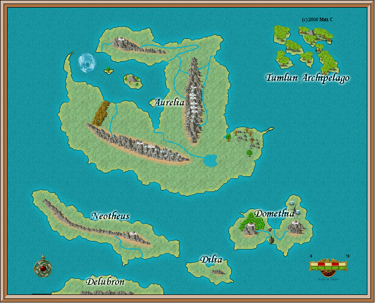
Hello! This is my first post and I want to tell you that I am thoroughly impressed with CC3 so far. (Yes, I'm a Newbie.) This map was created with inspiration from after watching J Sweeney's Tutorials. It's also planned to be used as reference for a fantasy book/series. (I'll enlighten you on that probably far into the future.) I haven't named the world (a lengthy process, becasue I want it to be a memorable name) yet I have named places in it. As you can see, I am not done at all, but I wanted to post it early so I could have some input for later on.
Looking at the map, one can probably tell I put the names on a little too early. Not to worry! I only put them on so I could just have them to remember. I will not be having them in the way when I finish working on it. I don't know about you, but it seems to me that the mountain chains on the big mainland are too thin for such a big area. Also, I don't know how to change the "scale in miles" to a bigger number. 50 miles for that distance seems too short for a map of this type. Hmm...
Let me know what you think!
Comments
Note that this value is set correct based on your map size when you started the map, so if 50 is to small now, that does mean that you have drawn your island/continents to small. Not that big a deal, but if you just change the number, then the measured distances on the map will be in error too, so you should probably rescale the entire map using the scale
Thanks, Monsen, for the pointer! Now on to the next task of finishing the map. I've decided to name the world Geolithia. It may sound like a clech`ed, or possibly it may sound utterly unheard-of. I've just chosen it for its Greek-sounding roots. Geo = earth. Lith = rock. The two may mean similar things, but it depends on the context. I am perfectly settled on the name.
I am considering to widen the mountain ranges so they will look more geologically realistic. Though I would like to hear some comments on it before I go forth with my decision.
Also, I have renamed this discussion to "Map of Geolithia" to be a more fitting and general name.