

Border issue + coastlines and terrain colours

Firstly, I'm very new to this program so apologies if the answer is something simple. I've searched tutorials and such, but cannot seem to figure out how to fix the issues I'm having.
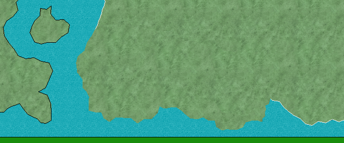
1) I created a landmass and proceeded to fill it with forests, towns, etc. I later realized one part wasn't big enough for what I needed to put there, so I spent ages trying to figure out how to use the edit function. I did, but each time I used the bordered default landmass and edited on part, both had borders which looked stupid as they overlapped and made no logical sense. I eventually made the edit/extended part a landmass without a border to try and fix this and thought I could just use the "outline in black" option, but nope. I cannot select the edited on bit at all. I also think if I did add a border to the new section (which is actually two bits) it would still have the extra borer. Basically, I just want to outline the entire mass and not bits of it. Every time I try to click it, only the previous portion gets selected as if the new bits don't exist. (see attachment)
2) As I'm new, I kept a lot of default settings and figured things out as I went. I'm very happy with my landmass (minus the above issue, of course) but some areas are meant to be sandy deserts or ashy ground, and others lush forests or snowy plains - I was wondering how to change the colour of certain parts of a landmass - like a paintbrush or something to "paint" some parts of land to match the intended terrain of forests, mountains, etc.
3) How can I add a shoreline? Like, a little glow effect for the coasts.
4) What's the purpose of the "key" box that automatically appears whenever I create a map? And how do I get rid of it (if it's going to be on the final result of the map and isn't just a tool box that appears for my editing benefit only)?
I really appreciate any help, as this map is for a project I've been working on a long time and would benefit from having a map of where the RPG takes place.
Comments
2. This is accomplished by using the relevant drawing tools. Click the default terrain button to get a list of the various terrain tools available for your style.
3. Add a glow effect to the LAND sheet. There should be some by default there, just turn on effects.
4. I am not quite sure what you are referring to here, but if it is a box saying something like "Floor 1" int he bottom right corner, that is a navigation box that appears because you selected to make your map multiple levels in the new map wizard. This is a feature mainly intended for floorplan/dungeon maps, and doesn't make much sense for overland maps.
2. I know about that, but it's only for creating a new area. What if I want to "paint" a part that already exists? And not the whole land, just a portion of it.
3. I went to the land sheet and had a look at the effects, but there's only 4 and have nothing to do with the coastline. Am I looking in the wrong area or...? Still very new to this, sorry.
4. I have included an attachment of the box I'm referring to.
2. No, that is also how you "paint" terrain. All the terrain drawing tools are meant to be used on top of an existing landmass, such as the desert tools, the forest tools, and so on. CC3+ is a CAD program, not an image editor, so you don't paint in the traditional sense, you add another entity on top with the appropriate fill.
3. You'll want a glow effect on the land sheet. If there isn't one already, you can add one. There should be around 25 effects to choose from.
4. I see. That is the the key belonging to the Symbol Set 1 Vector Style. I am unsure why you are using this template at all, since you are obviously using the CC3 standard overland fills in your map. In the future, I strongly suggest that you use the template belonging to the style you wish to use, that simplifies things greatly. Since you are not using the fills that belong to this style, the key will definitely be wrong so you should probably just delete it (it may be on a frozen layer, so you may need to thaw the layer before you can select and delete it. As for your original question, yes, this is an actual part of the map, and will accompany the map on export, etc, it is not just a drawing aid.