

Working with mountain ranges

Here's a little map I made with the Herwin Wielink style -- the red lines are help lines for the layout.
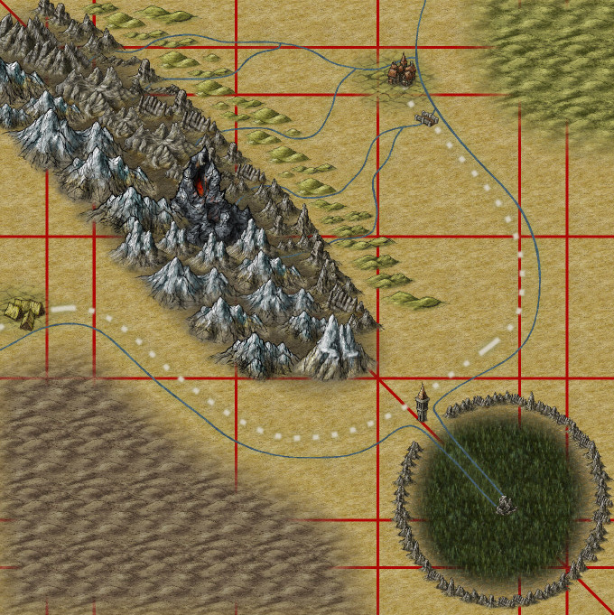
The diagonal line is supposed to be a fault line, as well as the watershed. The coast (not pictured) is to the north-east, so ocean air comes in from there. As it is forced upwards by the mountains on the fault, it rains down, eroding the mountains on that side -- so the south-west side of the range has steep peaks, whereas the north-east side has smaller peaks. South of the range is therefore pretty arid, and in the north there's plenty of streams.
At the south-east is a big caldera from an old volcano, now filled with a pine forest. Twin rivers originate from within there, with one going to the south and the other to the north -- the fault line is also the watershed, and the tower is built at the highest point of the "Low Pass" (which is the road shown). So it ascends from the village to the tower (going upstream), and then descends again from the tower to the town (going downstream).
I'm not quite sure I'm satisfied with this map. I think the mountain range is too 'busy', but I'm not sure how I could show the difference in which kinds of peaks are where. I also think that the whole road looks a bit 'flat' -- how should I give this more sense of depth?
Comments
By using larger mountain symbols you reduce the number of symbols in a mountain range.
My only suggestion - as this is a "perspective" style map, I would turn that caldera from a circle into a bit of an ellipse to maintain the illusion of perspective...
Just my opinion!
You might also try making the northeastern hills line a little less regular - maybe mix a few in with the mountains, say.
The caldera is definitely too regular, I think, and perhaps also a little too large (by contrast to the width of the mountain range). JMunson's comment about making it more elliptical would certainly help, but maybe the whole caldera should be elongated along the fault line as well?
Wyvern, I'm not sure I understand your advice correctly. Are you suggesting that there should be room in between the higher mountains to the south-west of the fault line and the smaller mountains to the north-east of it? And then fill that up with a lava background with the volcano in the middle? Or something else?
I did add some different-coloured hills to the area at the north-east -- the "background hills" is a fill style, so I put some symbols on top.
What do you think?
For the hills, I was actually meaning the line of green hills that lie immediately to the northeast of your "fault-line" mountains. They look oddly detached, as if the fault-line might really run between them and the lower mountains to their southwest. That kind of quite dramatic terrain change can indeed happen along opposite sides of a fault-line sometimes. That's why I suggested making these green hills more interspersed with some of the mountains there, to remove that impression. But you could simply adjust things a little to have the fault running along that valley instead. Faults don't have to follow neat, straight lines.
Of course, faults can also move horizontally, so there might be a displacement between features on either side of the line too - maybe even part of the caldera that doesn't match up with the rest of the ring, if you wanted it to be really dramatic!