

Merydyan: a 'commissioned' map
 LadieStorm
🖼️ 50 images Surveyor
LadieStorm
🖼️ 50 images Surveyor
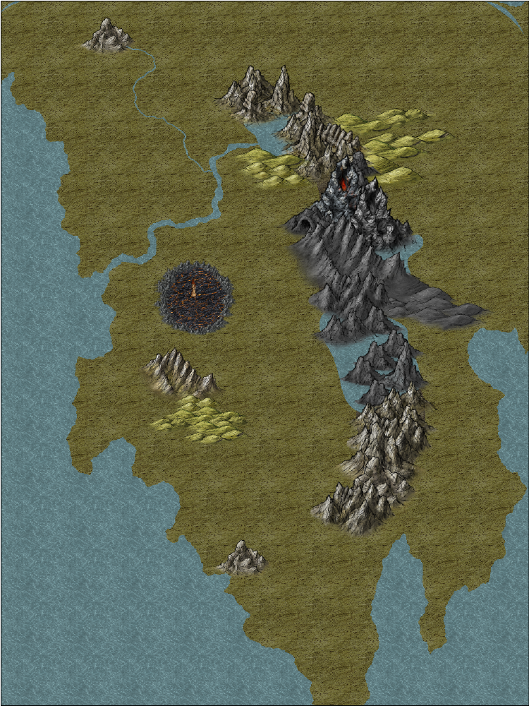
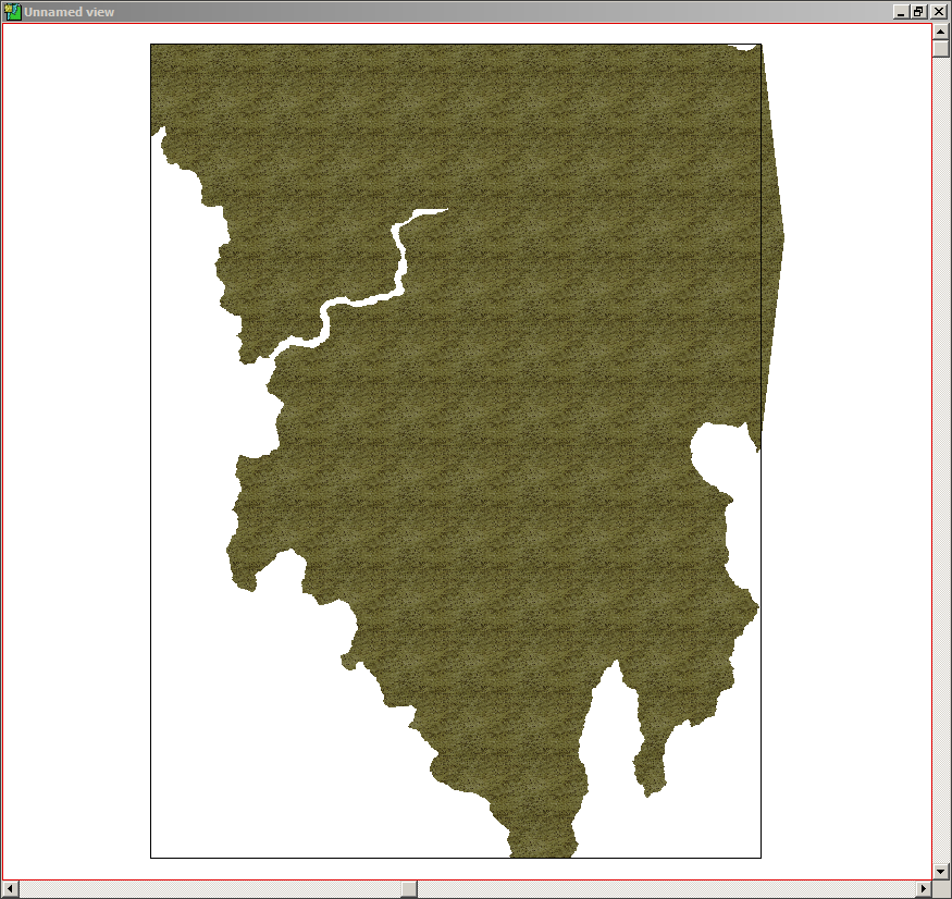
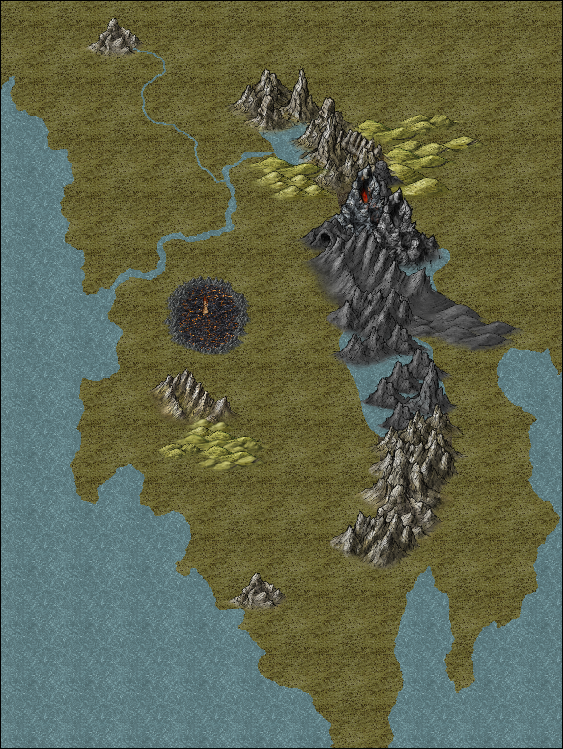
The May/June mapping lite challenge is to map a country for a book. There are specific criteria that has to be met, as it is supposed to represent a commission. So all of the elements you are seeing in this map so far are things that have to be there - such as the mountain range with the volcano, a dungeon entrance near said volcano, the three solitary mountains, and the 100 mile wide crater with the wizard tower in the center.
I decided to use the Herman Weilink style for this map project, because between the molten rock bitmap fill, and the volcanic rock symbols, I thought I could generate 'realistic' crater.
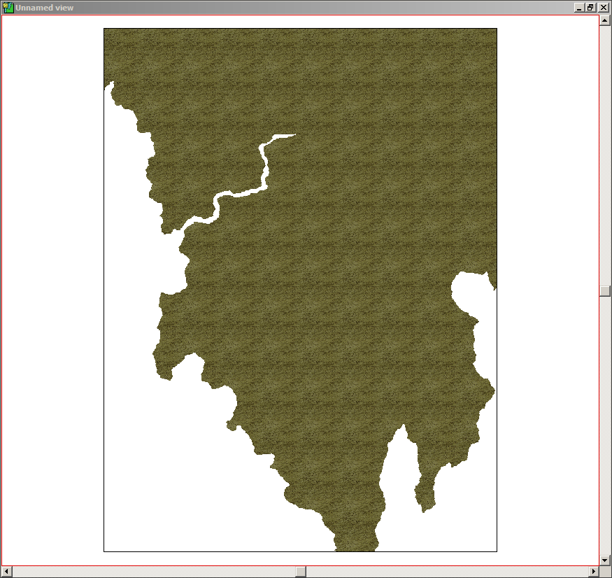
I am running into a rather small issue, so I'm going to be posting both the png, and the fcw for this map. I think this issue also happened in my Aeterna map, so I'm hoping someone can figure out why it's happening.
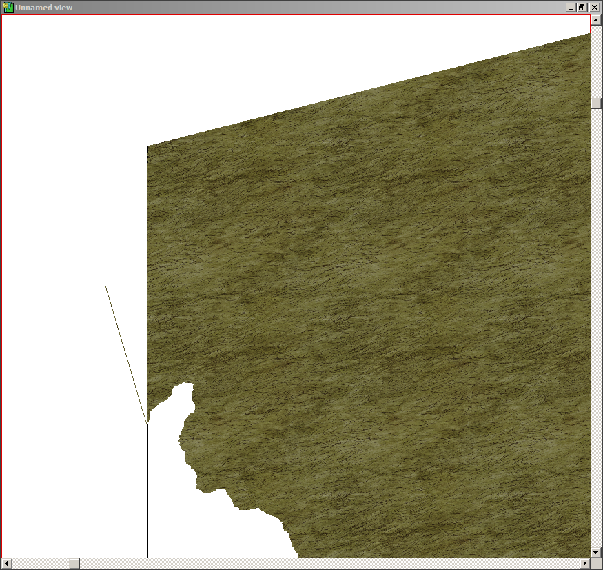
It appears that, if I fractalize or smooth anything on my map, my land mass fractalizes or smooths as well. I didn't fractalize or smooth my land mass this time... instead I went in with the land mass edit to add or cut away land to get the the rough or smooth coastlines that you see. I did, however, smooth the rivers that I have done so far. With the largest river, that's actually a combination of a smoothed river line to get the general shape, followed up by a land mass edit to have it open up into the sea. I then did a smaller river from one of my solitary mountains, and connected it to the larger one.
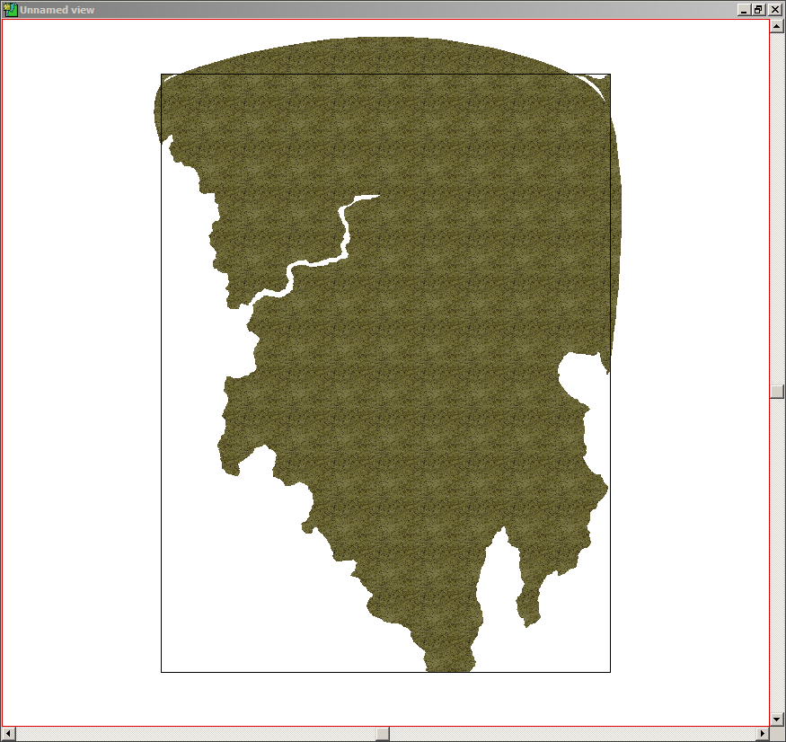
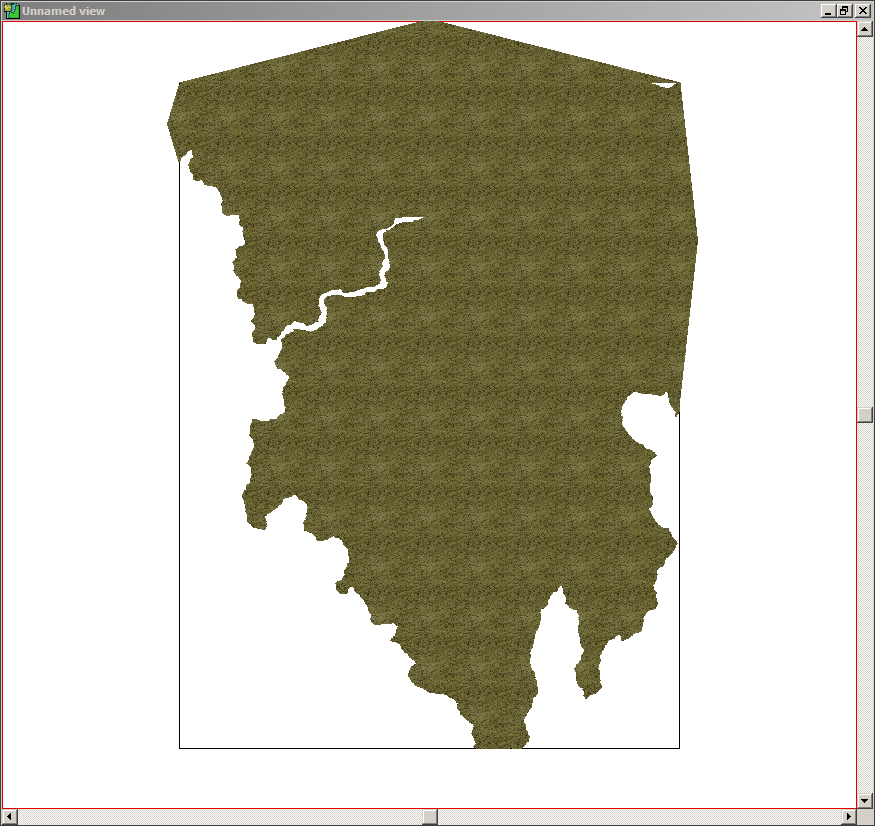
So how can I keep this from happening? I've tried to fix it with further landmass edits, adding land mass back to those two areas in the top two corners, but as you can see, I wasn't very successful.
I decided to use the Herman Weilink style for this map project, because between the molten rock bitmap fill, and the volcanic rock symbols, I thought I could generate 'realistic' crater.
I am running into a rather small issue, so I'm going to be posting both the png, and the fcw for this map. I think this issue also happened in my Aeterna map, so I'm hoping someone can figure out why it's happening.
It appears that, if I fractalize or smooth anything on my map, my land mass fractalizes or smooths as well. I didn't fractalize or smooth my land mass this time... instead I went in with the land mass edit to add or cut away land to get the the rough or smooth coastlines that you see. I did, however, smooth the rivers that I have done so far. With the largest river, that's actually a combination of a smoothed river line to get the general shape, followed up by a land mass edit to have it open up into the sea. I then did a smaller river from one of my solitary mountains, and connected it to the larger one.
So how can I keep this from happening? I've tried to fix it with further landmass edits, adding land mass back to those two areas in the top two corners, but as you can see, I wasn't very successful.
Comments
This is one of the downsides of making rivers this way, since when you make them as a cutout, they are a part of your landmass, instead of a separate entity which you can manipulate freely. And a single polygon needs to be either straight or smooth, you cannot have both in one.
I can't reproduce the problem on the map you posted. I was able to fractalize the rivers (the real river entities), the lakes, and the mountain terrain without having any visible effect on the landmass.
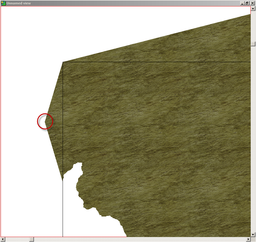
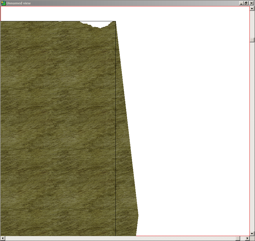
The blue areas on the upper left and right corners appear to be caused by extra nodes in the landmass and the outline of the landmass entity "folding" over itself in those places.
~Dogtag
I smoothed the guide line, NOT the cut out. I have worked with the program long enough to know better than that
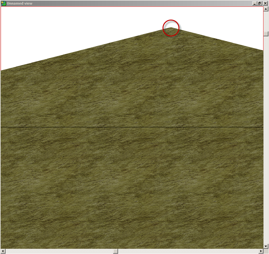
And I have had this issue before, I just didn't realize it until it happened on this map. If you look at my Aeterna map, on the left edge down the side of my map border, you will notice a small bit of water on the edge of the map. I ended up covering most of it up with terrain fills, but there is still a tiny piece that you can see. If I were to hide everything except land and water, you would see that 'folding' that Dogtag mentioned. And it's JUST on that one land mass, the lower West continent.
To fix the weird "folding" effect that exposes the water, you should use the node editing tools (lower left toolbar buttons). The easiest way to do this is to select the Land sheet and then hide all other sheets. Then you can zoom in on the troublesome areas and delete nodes at the corners of the water, which will help "unfold" the poly. Again, since this is a smooth poly, however, you may need to delete several nodes to achieve the desired effect. You'll probably have to add and move nodes when you're done since deleting nodes will smooth the landmass even more across the top, and it will almost certainly wind up inside the map border. You can check that by unhiding the Map Border sheet. If you want to leave the map border visible while you work (not a bad idea) be sure to freeze the Map Border layer before you begin work so you don't accidentally select the map border.
Another thing that might help is to turn on the smooth poly frames (Tools>Drawing Aids>Toggle Frames or press Ctrl+F), which will help you see where the actual nodes are located (they are almost never on the smooth poly itself).
I hope that helps.
~Dogtag
And I actually plan to attempt a different map border, if I can figure out how to do it right. I tried to create a frame once before, but I couldn't get my corners to line up correctly.
Which brings me to a question I hope someone can answer, or course I guess I could just try it and see what happens. But what I thought about doing, was on the map border sheet I would apply a rectangular overlay to the map. I was hoping it would only cover the border itself, and not the entire map as well. Anyone have any suggestions?
I've attached the resulting FCW below, but if you want to do it yourself — which I recommend — here's how. If desired, click the images to view full size.
- Hide all sheets except LAND and MAP BORDER.
- Freeze the Map Border layer.
- Right-click the Fractalise button
 and select Smooth to Straight from the pop-up menu.
- Select the landmass, right-click, and select Do It from the pop-up menu.
- Zoom in on the upper left corner.
- Click the Delete Node button
 and then click the node extending past the border.
- If necessary, scroll up and to the right until you see the node extending up from the map border.
- If you haven't refreshed yet, simply left-click in the map window to repeat the last command, which should be Delete Node. If you did refresh (or used any other command) then click the Delete Node button again. Then select the node at the top of the landmass to delete the node.
- Zoom to Extents to check your progress.
- Zoom into the upper right corner.
- Delete the nodes along the white spaces. For some reason, there are maybe a couple dozen or so nodes here but keep deleting them until the landmass fills to the map border.
- Delete the node extending out to the right of the map border. You may have to scroll down and to the right to see it.
- Zoom to Extents to view your handiwork.
- Unhide all sheets and, if desired, unfreeze (thaw) the MAP BORDER layer.
I hope that helps.CC3+ may still display part of the deleted area of the landmass but this will vanish on refresh. HOWEVER, to make things easier, don't refresh yet.
Notice there's a tiny little white space to the left of the larger white space.
Cheers,
~Dogtag
Cheers,
~Dogtag
Cheers,
~Dogtag
Again, just some suggested tweaks. I think it looks really good as it is.
Cheers,
~Dogtag
Then again, in the early days of my garden here, some neighbors called me a "Ruinenbauer" (ruin builder). So it goes.
Of course, if the areas (crossroads/bridges) are dangerous, it also makes sense that travelers would avoid them if they can. In the case of bridges, that might not be possible but, with crossroads, they might blaze a new route. If you decide to go that route (heh), it could also help with the story you're writing, possibly giving rise to mercenary/security escort groups who take advantage of such danger and who may have grown a thriving presence at the route endpoints.
But, again, the map looks really nice as it is now!
Cheers,
~Dogtag