

Snap to feature problems

Hi, attached are two files showing what I'm running into when trying to activate the "on" connector button to connect my river line feature to the coastline (land polygon). I draw my river, no problem, and then when I click "on" the command line shows "Entity:" but won't let me click anywhere on the landmass border. It just goes back to waiting for another left-click waypoint in the line feature I'm drawing.
This sprung up as I was going through the very first set of youtube tutorials. I have been following them to the letter, until I hit this point. I'm doing everything he does in the video, but my river will not connect to the coastline for some reason. Assistance much appreciated, I'm sure I'm missing something simple!
This sprung up as I was going through the very first set of youtube tutorials. I have been following them to the letter, until I hit this point. I'm doing everything he does in the video, but my river will not connect to the coastline for some reason. Assistance much appreciated, I'm sure I'm missing something simple!
Comments
If that's not the problem, please post the FCW file here, I'll take a look.
The way the video made it look, you hover your mouse and it snaps - but either way, I've tried clicking right on the coastline to get the river to end there - but it doesn't actually connect. It just drops another waypoint and waits for a right-click to end the path.
If I right-click on the coast, of course, it completes the path at the last waypoint, well short of the coastline.
I am at work right now but will post my FCW file when I get home this evening.
I was playing around with the grid size, and it seems as if there is some relationship there - the default is set to '20mi, 2 snap'. Right-clicking on the Attach button is correctly set to 'Nearest entity, On'.
Other than that hiccup I've been really enjoying this software. I'm a longtime ArcMap user in my day job, so the workflow isn't hugely jarring to me as I'm very used to working with vector data (I've actually had more trouble learning the photoshop/GIMP concepts).
Try starting a river, then press F9 (shortcut for ON). The pick box appears at the mouse cursor. Click the coastline. Is the river attached to the coastline now?
I've been out of town for a bit and tried this today. I also tried reinstalling CC3 and CC3 update from scratch. No dice. It's still doing the same thing; refusing to attach to the coastline.
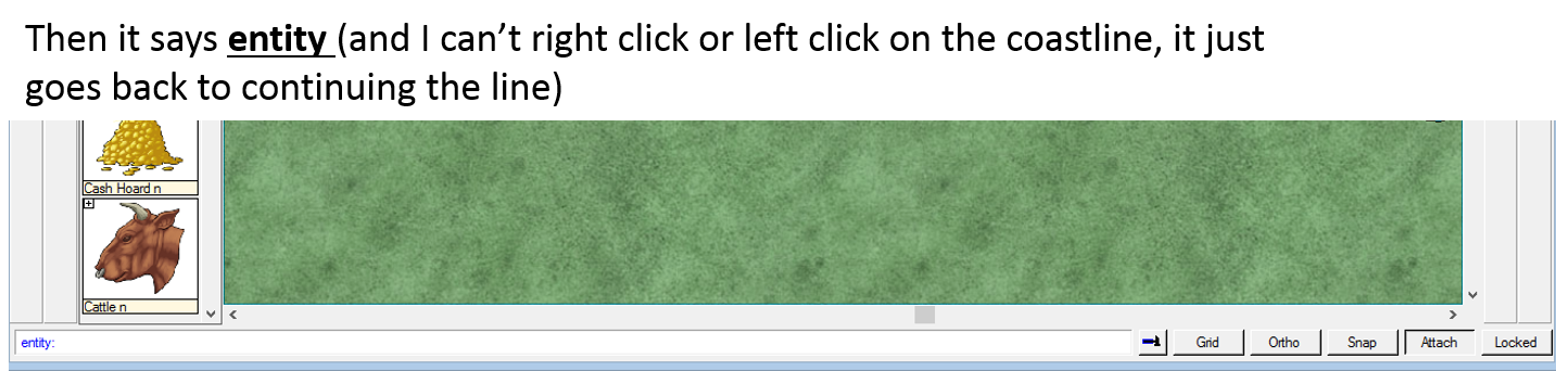
Basically the problem is this: it won't accept a right-click "end" command after I've selected "On" (by the button, or using F9). The status bar instead reads:
"Next point (DEL - back, Space - Randomize, L/R Arrows - Depth, U/D Arrows - Strength, T - Trace):"
I did try doing a node edit on the landmass, and that works fine.
I'm just a tiny bit more than frustrated here, seeing as this is one of the most basic parts of what software like this is good for. I want to get busy using this and I have no problems following the concepts (given that I work with vector data in my job every day) but I really kind of need a hand here. Thanks for any advice!
Again, I'm following the tutorial to a T.
If there's a better way, I'd love to hear more about it, though.
I see what you're saying, but it's not technically correct. What I did in those cases was, just eyeballed it up as best I could, and dropped an intermediate point using the left mouse button, closing it with the right mouse button.
The main problem here is that the Attach functionality simply does not work on my system. I think this may be a bug with Windows 8.1 x64 or something? Not sure. I've attached another, more high-res shot below showing how it works with Attach:On enabled. Again, it will not allow me to establish a terminal point with the right mouse button using the Attach:On functionality.
There are manual workarounds of course, i.e., creating hyper-precise polygons that have the river "built in" as part of the land mass - but this is far from optimal.
Here's the pic:
1. You're drawing your river, left clicking to place nodes and nearing the coastline.
2. You click the On modifier, the command line reads "Entity", meaning CC3 expects you to pick an entity to use "On" on.
3. You left-click to select the entity, the coastline in this case. A right-click cancels the modifier instead, going back to normally placing points again.
4. The left-click should have placed the latest river node on the coastline. You now right-click to finish the river command.
If you do it this way, does On still not work? Actually I'm using Windows 8.1 64-bit here myself, so it's definitely no a problem with CC3 under that OS. If it still doesn't work, can you send in a tech support request from your registration page. That will be easier to handle than here on the forum.