

The Four Kingdoms-My First map

I recently bought CC3 and after following the long tutorial on Youtube, I tried to make my own map in a similar style.
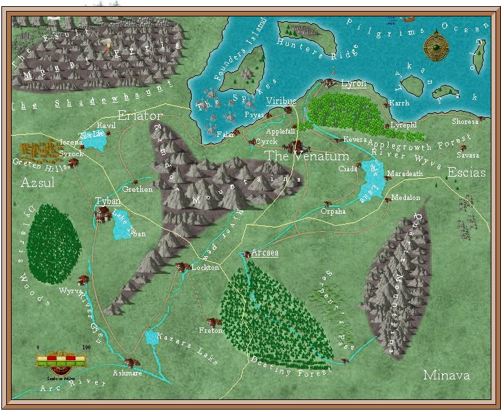
It's full of detail but I wonder whether it would have been better if it was a bit bigger so some of the features can stand out a bit more.
Nevertheless, here it it.
Enjoy!
It's full of detail but I wonder whether it would have been better if it was a bit bigger so some of the features can stand out a bit more.
Nevertheless, here it it.
Enjoy!
Comments
I would crop the export to get rid of the peaks extending beyond the map border at the top (do "Save as rectangular section PNG" to do that on the export).
Try to use some hill symbols around your mountain areas. Mountain ranges don't usually spring up from th plain without some hilly regions.
I'd probably try to tighten up the text labels somewhat. Don't do serpentine text labels, they usually look weird. If you have arced text, keep it to a single arc. Also, you might want to try to use dark text and give it a tight white outline with sheet effects.
There are naturally details to be thought about, such as river flow directions and how/why the terrain causes your rivers to do what they are doing, but if you are primarily mapping to just get the feel of the program, then that hardly matters!
Looking at maps makes me realize how I need to get back to mapping, fun stuff.