

Fantasy Foundation Project
 kmunoz
Newcomer
kmunoz
Newcomer
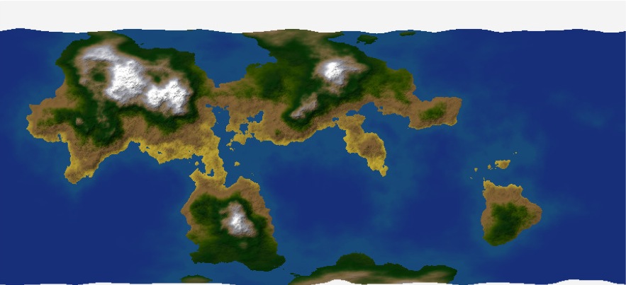
I'm working on a fantasy campaign world and have been generating maps for the first kingdom I'm writing up. The world map was made with FTPro, then exported to CC3 with all possible data. I then used a custom script to separate the layers out into distinct sheets. These sheets include contour lines etc. which I then used to figure out riverways and climate. The CC3 results are amateurish at best (I have a very poor aesthetic eye), but perhaps I will get better. Each zoom inward is based on the FTPro original: I do initial exports from FTPro at various zoom levels and positions so I can let the program handle the levels of detail.
The Seven Kingdoms map is located on the northern edge of the bottom continent in the cluster of 3 continents on the world map.
The Seven Kingdoms map is located on the northern edge of the bottom continent in the cluster of 3 continents on the world map.
Comments
http://ffp.wikidot.com/
The package I'm doing now (0.50) is gonna place near infinite possibilities into FT Pro. I'm not boasting - I'm just saying that I have made SOOOOoooo much stuff for it that you could probably rifle through it for the next 5 years and not exhaust all of the possible permutations of combining all the the various map ingredients that I've stuck in there. Actually I'm thinking overkill, I have decided to omit a few things from it because the package seemed to be getting too chunky for this release, this time around, lol - but I love making this stuff and then setting it lose to see what you kids do with it. It's an awsome cool thing.