This is my first map and I'm almost done. There's a few problems i don't know how to fix as you'll probably see, but my biggest problem is that my rivers and paths look really pixely and weird. How do I fix it?
Seems like you did it right the first time. Uploading .fcw files are great for people to get a better look at your map, but since they are not image files, they will not preview in the post, they will only be listed as files you can download.
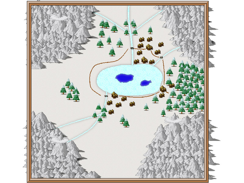
To get rid of the mountains sticking out, draw a white polygon just outside your map border on the "MAP BORDER" sheet. This will cover up the mountain.
As for the rivers, either export in a greater resolution (lower resolution will always cause pixleration), or use antialias (found by clicking the options button in the save as dialog after selecting an image filetype), or even better, use both larger res and antialias.
Ok so I got rid of the mountains easy enough but apparently theres some glitch that keeps me from changing the resolution the way you said, but I followed someone elses directions to make it look clearer but it didn't make a big difference. Anyways despite the pixel problem what do you think of the picture itself?
Posted By: gorgeboyapparently theres some glitch that keeps me from changing the resolution the way you said
1) Do you have the latest patch (Update 8, brings CC3 up to version 3.40) 2) Did you make sure to select an image filetype (bmp, jpg, png) in the "save as" box before clicking the options button. The button presents the options for the currently selected filetype, so if you haven't select an image type first, you won't get the right options. 3) Also note that you can use the "rectangular selection" option to just export your map itself, and not the all the white surrounding it.
As for the map it is a nice starter map. The empty areas look perhaps a little bit too empty though. Maybe a few small hills or something to break them up a bit?
Ok so the options button was sort of hidden under the help button for some weird reason so i went into the options and the things i can change are Bitmap Size, BMP (clipboard), PNG compression, Unused Area and JPEG quality. There was nothing about resolution or antialias and JPEG quality didn't change anything. Also when I try to make it a rectangular selection it wont save.
Use the pointer pointer to draw a rectangle/square showing what you want as a final result. ( Place mouse pointer upper left corner, drag to lower right corner, let go the mouse button.)
Posted By: gorgeboyOk so the options button was sort of hidden under the help button for some weird reason so i went into the options and the things i can change are Bitmap Size, BMP (clipboard), PNG compression, Unused Area and JPEG quality. There was nothing about resolution or antialias and JPEG quality didn't change anything.
Then you don't have the latest patch. Log into your registration area and download it. It will give you a lot mor options, and will also fix the "placement issue" with the options button.
Also when I try to make it a rectangular selection it wont save.
Did you tell it what area to save? When you tell it to save using a rectangular selection, the next thing it expects from you is for you to give it the upper left and lower right corner of the export (or any two points that define oposite corners in a rectangle).
I downloaded all the patches and nothing happened so i assumed that wasnt the problem but recently I discovered how to look up the version the program is running under and it says its version 3.03! Why didnt it work?
Just thought I'd throw out that if you go to File -> Save As..., if you look through the "Save as type:" pull down list, you will see options for Rectangular section BMP, Rectangular section JPG, and Rectangular section PNG. Those options let you select your own starting point and an ending point to define a box with the exact dimensions and content you want your image file to show from the whole map. It's a great time saver and I use it all the time.
Posted By: gorgeboyI downloaded all the patches and nothing happened so i assumed that wasnt the problem but recently I discovered how to look up the version the program is running under and it says its version 3.03! Why didnt it work?
Are you running under Vista(or Win 7)? If so, you might need to right click on the patch installer and select "Run as Admin". Due to the way UAC operates, it is possible to have an install process complete successfully, and no real changes were made (They are hidden in a shadow folder).


Comments
As for the rivers, either export in a greater resolution (lower resolution will always cause pixleration), or use antialias (found by clicking the options button in the save as dialog after selecting an image filetype), or even better, use both larger res and antialias.
2) Did you make sure to select an image filetype (bmp, jpg, png) in the "save as" box before clicking the options button. The button presents the options for the currently selected filetype, so if you haven't select an image type first, you won't get the right options.
3) Also note that you can use the "rectangular selection" option to just export your map itself, and not the all the white surrounding it.
As for the map it is a nice starter map. The empty areas look perhaps a little bit too empty though. Maybe a few small hills or something to break them up a bit?
Btw thanks for all the help!
Just import the bmp or png into Irfanview http://www.irfanview.com/
Use the pointer pointer to draw a rectangle/square showing what you want as a final result. ( Place mouse pointer upper left corner, drag to lower right corner, let go the mouse button.)
You should now have a rectangle/square there.
hold down the ctrl key and tap the y key.
Now save the trimmed bmp or png.
You now have it the way you want it to look.