

Sheet effects don't look the same on different islands/continents
Hi!
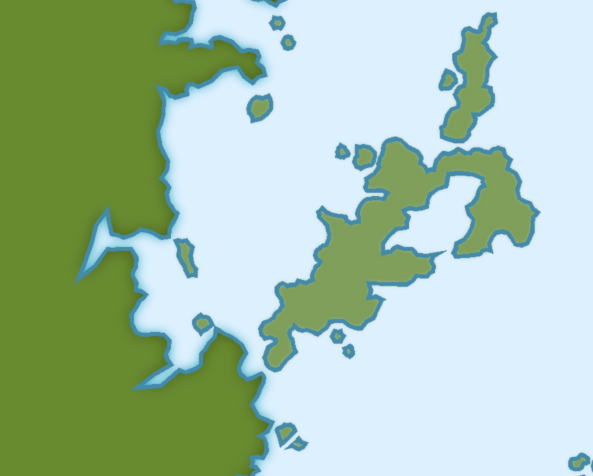
I have made a big map (land contours only for now) with the CC3 Vector Color style and when I tried to activate the standard effects I found that the big continent looked different than the smaller islands, though I used the same tools to draw them and, as far as I can tell, they are on the same sheets and layers.
I have attached a small, zoomed view of a small part of the continent and some islands that should show you what I mean.
Where does this come from, and how can I achieve the same look for all landmasses?
Comments
Looks quite weird.
Can you post the fcw file ?
I also have attached the fcw-file.
Only the main land body is on the LAND sheet.
Select the LAND FEATURES sheet and check Hide All But Common...
Move to sheet
type A (for all) N (for not) and select the 4 border lines and the scale bar. Do it. LAND.
That should be OK.
(Your file is hhhhhuge !)
It's weird, though. How come the blue outlines were on the LAND sheet but the green "land" was on LAND FEATURES?
And how do I select the green lands. Normally I can only select the blue outline which seems to include the green land.
Yes, I know it's huge. It's not an original map of mine, I'm just "remapping" hand drawn map, else I would have started smaller
Normally, the green body should be on the LAND sheet as you say but the blue outlines should be on the COASTLINE sheet.
There's an easy way to sort that out, it's too rely on the different colors.
As before, best is to work on one sheet at a time, namely now the LAND sheet. So select it and again hide every other sheet.
Now launch move to sheet as before (movesht ENTER in the prompt) and type C (for color) then 68. This way, you'll only select those outlines. Please move them to the COASTLINE sheet where they belong.
Selecting overstacked entities is always hard. You must use the difference between two identical entities. In your case, "entitically" speaking, there is no graphic diffirence between the land and the coastline because the land is in fact the same polygon as the coastline, only filled. There is luckily the color difference.
CC3 has a very powerfull selecting pannel. You can select by color, layer, fill style... When all else failed, there's the last resort : numeric edit. That's for two 100% identical entities. The only way to separate them is the tag order that you'll get with the list command.
The other great tool is the combining. If you want to select only one specific outline of your map, you can select it, thus also selecting the corresponding land. To unselect it you have the choice of B (both, logical AND) C (color) 68 or N (not) C (color) 116 (which is the color of the land).
I hope it's clear enough...
There's a better help on selecting here :
http://www.profantasy.com/articles/download/001PowerUpYourSelections.pdf
Have a nice mapping.